


The Revised Shoreland Protection Act 2008
The Revised Shoreland Protection Act 2008
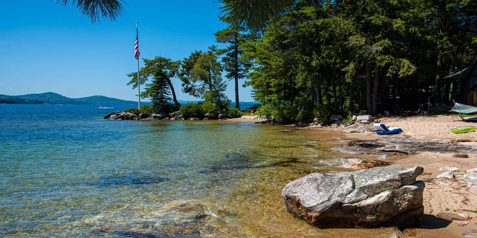
The shores of the state are among its most valuable and fragile natural
resources and their protection is essential to maintain the integrity of
public waters. NH DES
As of April 2008, the Department of Environmental Services has instituted
the most stringent regulations with the revised Shoreline Protection Act.
for a complete list of regulations please visit the DES site by clicking on
the link.
http://www.des.state.nh.us/cspa/
So as to make your head spin, here is an outline of the details.
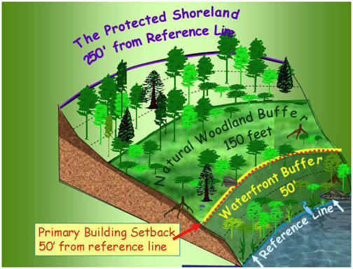
250 Ft. from Reference Line-THE PROTECTED SHORELAND:
Impervious Surface Area Limitations
.
Impervious surface area is limited to 20%. This may be increased to:
•
25% with 50 points of tree coverage in each 50 foot x 50 foot grid segment
in the waterfront buffer (WB), and a no cut deed restriction in the
waterfront buffer.
•
30% with 50 points of tree coverage in each 50 foot x 50 foot grid segment
in the waterfront buffer, a no cut deed restriction in the waterfront
buffer, and a DES approved stormwater management plan.
Other Restrictions:
•
No establishment/expansion of salt storage yards, auto junk yards, solid
waste and hazardous waste facilities.
•
All new lots, including those in excess of 5 acres are subject to
subdivision approval by DES.
•
Setback requirements for all new septic systems are determined by soil
characteristics.
•
75 feet for rivers and areas where the there is no restrictive layer within
18 inches and where the soil down gradient is not porous sand and gravel
(perc>2 min.).
•
100 feet for soils with a restrictive layer within 18 inches of the natural
soil surface.
•
125 feet where the soil down gradient of the leachfield is porous sand and
gravel (perc>2min.).
•
Minimum lot size in areas dependent on septic systems determined by soil
type.
•
Alteration of Terrain Permit standards reduced from 100,000 square feet to
50,000 square feet.
•
The number of dwelling units per lot shall not exceed 1 unit per 150 feet of
shoreland frontage.
150 ft. from Reference Line-NATURAL WOODLAND BUFFER RESTRICTIONS:
• Within the area between 50 feet and 150 fee shall be maintained in an undisturbed state.
50 ft. from Reference Line-WATERFRONT BUFFER and PRIMARY BUILDING SETBACK:
•
All primary and accessory structures must me set back at least 50 feet from
the reference line. Towns may maintain or enact All primary and accessory
structures must be set btheir own setback only if it is greater than 50
feet.
•
Within 50 feet, a waterfront buffer must be maintained.Within the waterfront
buffer, tree coverage is managed with a 50-foot x 50-foot grid and points
system. Tree coverage must total 50 points in each grid. Trees and saplings
may be cut as long as the sum of the scores for the remaining trees and
saplings in the grid segment is at least 50 points.
•
No natural ground cover shall be removed except for a footpath to the water
that does not exceed 6 feet in width and does not concentrate stormwater or
contribute to erosion.
•
Natural ground cover, including the duff layer, shall remain intact. No
cutting or removal of vegetation below 3 feet in height (excluding lawns)
except for the allowable footpath.
•
Within 50 feet, stumps, roots, and rocks must remain intact in and on the
ground.
•
Chemical applications (including but not limited to pesticides and
herbicides) are prohibited. Low phosphorus, slow release nitrogen fertilizer
may be used for the area that is beyond 25 from the reference line. No
fertilizer, except limestone, shall be used between the reference line and
25 feet.
REFERENCE LINE:
For coastal waters it is the highest observable tide line; for rivers it is
the ordinary high water mark; for natural fresh waterbodies like lakes and
ponds it is the natural mean high water level; and for artificially
impounded fresh waterbodies it is the elevation at the spillway crest or the
elevation of the state's flowage.
NON-CONFORMING STRUCTURES
Are structures that, either individually or when viewed in combination with
other structures on the property, do not conform to the provisions of the
CSPA, including but not limited to the impervious surface limits of RSA
483-B:9V(g). They may be repaired, renovated, or replaced in kind using
modern technologies, provided the result is a functionally equivalent use.
Such repair or replacement may alter the interior design or existing
foundation, but shall result in no ragraph II of RSA 483-B. expansion of the
existing footprint except as authorized by the department pursuant to
paragraph II of RSA 483-B
A SITE ASSESSMENT
is required prior to executing a purchase and sale agreement for any
“developed waterfront property” using a septic disposal system and which
is contiguous to or within 200 feet of a great pond (a public water of more
than 10 acres) as defined in RSA 4:40-a and upon which stands a structure
suitable for either seasonal or year-round human occupancy.
If your head is spinning, you are not alone.
For more information, please visit the DES Shoreland Website at
https://www.des.nh.gov/cspa
The info above was copied from the DES site. Use this info as a guide.
It is suggested you contact DES or go to their site for the latest info
as -you know--the government is entitled to make changes.

Connect